In February 2023, we returned to the Canary Islands for some geological adventures in the winter sun (for those of us in the northern hemisphere!) Our group consisted of participants from the UK, the Netherlands and the USA, and James was assisted on this trip by Dr Martin Whiteley.
Last time we were in the Canary Islands, in January 2022, the recent Cumbre Vieja eruption on La Palma had only just stopped. This time, we were able to take a guided tour into the ‘exclusion ‘restricted area’ to see some of the youngest lava on the islands close up, along with many other great geology sites on La Palma. Our tour also took in the sights of Tenerife and La Gomera, with our group ascending the mighty Mount Teide, exploring lava tubes and enjoying the beauty of the Garajonay National Park World Heritage Site. We were lucky that the weather was good enough to ascend to the top of Mount Teide, but then we were thwarted by the weather on La Gomera and not able to take a boat trip to Los Organos – you can’t win them all! Despite this, we had nine fabulous days exploring this most fascinating of island groups. We will be returning in 2024 – if you would like to join us, please see our Canary Islands web page for dates, prices and availability.
GeoWorld Travel’s ‘Volcanic Island Hopping’ trip route map
Here are 40 of our favourite photos from this year’s trip – click on the images to enlarge.
Above, from L-R: Inside the Cueva del Viento lava tubes. Outside Hawaii these are the longest in the world and occur in 27,000-year-old basalt that erupted from Pico Viejo, a parasitic cone of Teide volcano.
A lava flow that was emitted from an eruption on the flanks of Mt Teide in 1706. When the lava flow reached the coast, it blocked the port of Garachico which was, at that time, was the capital of Tenerife and a major port linking Spain to the Americas. The fort in the back ground marked the entrance to the port.
Los Gigantes. These 600m high cliffs are made from 5-million-year-old lava that formed in the Teno volcano, an ancestral volcano of Tenerife.
Above, from L-R: The Boca Cangreyo cone, which was seen erupting by Christopher Columbus, en route to discovering America in 1492.
The Chinyero volcano erupted in 1909 and is youngest volcano in Tenerife.
A rare case of two very different magmas that possibly emitted in the same eruption. The bottom layer is basanite while the upper portion is the more evolved magma phonolite.
Above, from L-R: Mt Teide (3,715m) is the highest mountain in Spain and was once thought to be the highest mountain in the world. To the left of Teide is Pico Viejo volcano; rather than being a separate volcano it is in fact a parasitic cone of Teide. On Pico Viejo’s left flank, a fissure and associated lava flow can be seen. This was formed in the 1798 Chahorra eruption which emitted tephriphonolite.
Ring dykes and cone sheets that were intruded as the original Las Cañadas volcano inflated and contracted.
A phonolite flow arresting on a steep slope demonstrating just how viscous it was.
Above, from L-R: The summit of Mt Teide
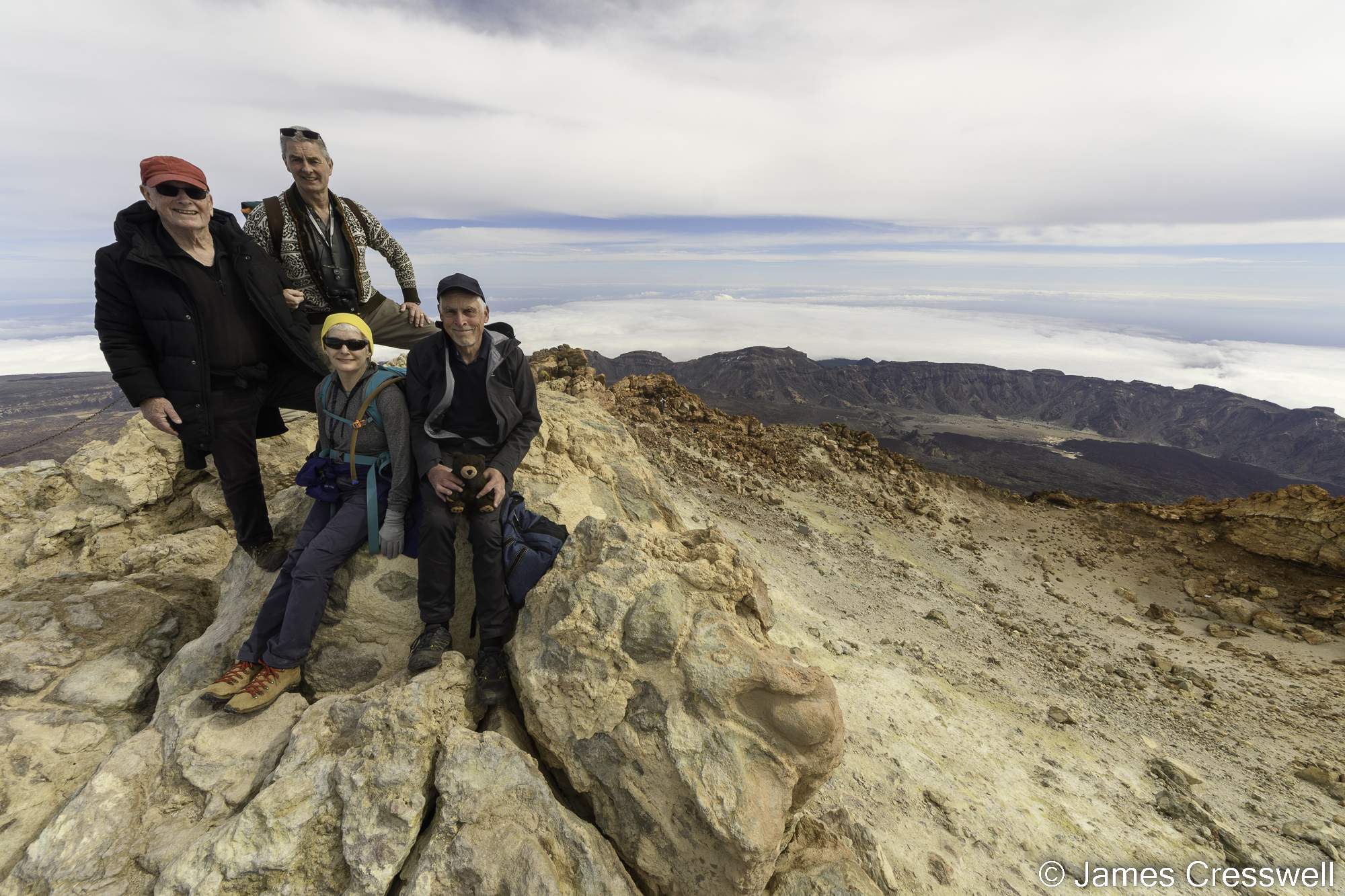
Peter, Martin, Darlene and Dan on the summit of Mt Teide. Teide’s summit crater can be seen to the left, and the escarpment of the Las Canadas caldera can be seen in the background.
The view of the path leading from the upper cable car station to the summit of Mt Teide.
Above, from L-R: The Roques de Garcia are made up of tuff layers, landslide debris and a sill. Mt Teide is in the background.
Walking on fossilised beach dunes with yellow palagonite tuff cliffs behind at Mña Amarilla, Tenerife. The palagonite was formed when a volcanic eruption began under the sea and the ash was hydrated. As the eruption continued it became subaerial and built the Amarilla tuff cone.
A huge dyke that would have fed fissure eruptions on La Gomera.
Above, from L-R: A dyke which cuts through red scoria that has been baked by lava that has flowed over it on La Gomera.
The Roque de Agando, a trachyte dome intrusion that has been revealed by erosion. The rock is 100m high on one side & 200m high on the other. Its summit was once a worship and burial site for the indigenous inhabitants.
Another trachyte dome and another archaeological site called La Fortaleza. The trachyte spread out below the surface without erupting and was later revealed by erosion
Above, from L-R: The Laurel Forest in Garajonay National Park & UNESCO World Heritage Site. These forests are relict ecosystems, living remnants of the old rainforests and warm temperate forests that occupied much of Europe and North Africa during the Tertiary.
Several dykes that are actually cone sheets radiating out of the magma chamber of a Miocene volcano that has since eroded away.
Volcanic ash from the 2021 Cumbre Vieja eruption covers the landscape.
Above, from L-R: Our local guide, Romen, shows pictures of the 2021 Cumbre Vieja eruption that formed the new cone Tajogaite. He is standing in exactly the same place as where the pictures were taken.
Our group and the new Tajogaite volcanic cone that was produced in the 2021 eruption.
Above, from L-R: A dyke with a beautiful chilled margin that cuts the Bejenado volcano.
A cliff that is a huge fault scarp, it formed in a massive landslip when part of the Taburiente volcano broke off and slid into the sea forming a huge tsunami.
Above, from L-R: Our group examine a dyke on a short hike from the Mirador Cumbrecita.
La Caldereta is one of the largest tuff (volcanic ash) cones in the Canary Islands. In the background is the town of Santa Cruz de La Palma.
The new Tajogaite cone that formed in the 2021 Cumbre Vieja eruption viewed from the summit rim of the Taburiente caldera.
Above, from L-R: Mt Teide on Tenerife viewed from the Roque de los Muchachos (2,423m) the highest point on the island of La Palma.
The view from the Roque de los Muchachos (2,423m), La Palma. In the far background is the island of El Hierro, coming forward is the ridge of the Cumbre Vieja volcano. In the mid-ground is the Bejenado volcano which forms the eastern wall of the Taburiente caldera and which formed after the giant Cumbre Vieja landslip.
The backwall of the Taburiente caldera with telescopes on top. The caldera wall is cut by many dykes. This an erosional caldera and is where the term ‘caldera’ was first coined back in 1815 by Leopold von Buch. He believed it was a “Crater of Elevation” and the lava had been precipitated on the sea floor (the theory of Neptunism). In 1854 Charles Lyell re-interpreted the caldera as an erosional caldera and later went on to debunk Neptunism showing that lava comes from volcanoes (Plutonism).
Above, from L-R: Our group being given a guided tour in the Roque de los Muchachos Visitor Centre, here we learnt all about La Palma’s telescopes and observatory.
The new Tajogaite volcanic cone and its devasting lavas flow that destroyed 3000 buildings in 2021, viewed from the Mirador del Time.
Pillow basalts in the Barranco de las Angustias. The rocks were formed by an underwater volcano or seamount and become of deeper marine origin and more metamorphosed as you progress up the barranco.
Above, from L-R: Two different generations of dykes cutting through submarine breccia. This breccia formed when the seamount was emerging and the water was too shallow to form pillow basalts.
Our group in front of an outcrop of pillow basalts.
The new Tajogaite cone that formed in the 2021 Cumbre Vieja eruption viewed from Tajuya Church, the same place where the world’s media filmed the eruption as it occurred.
Above, from L-R: Allen stands on a large levee at the edge of the 1712 lava flow.
The San Antonio volcano is one of La Palma’s most famous volcanoes. The spectacular cone has recently been shown to have formed around 3,000 years ago and not in 1677AD as previously thought. This large cone would have had a very violent phreatomagmatic (with water) eruption. In 1677 there was another eruption the from two vents on the side of this cone, which covered the whole cone in scoria from this period.
The Tenequia cone and the lava flows that flowed from it. This erupted in 1971, and until the 2021 eruption were the youngest eruption in the Canary Islands.


