In April 2024, we welcomed a group of geology enthusiasts on our ‘home’ tour of England & Wales – the Jurassic Coast & the Complete Geologic Timescale tour. Our group was made up of travellers from the USA, the UK, Canada and Australia. Over the course of eleven full touring days, we visited a wide range of sites covering almost every period in the geologic timescale!
Below are some of our favourite photos from the trip. If you would like to join us on this trip in the future, please be sure to check out our website where you will find the latest dates and availability: https://www.geoworldtravel.com/england-and-wales.php
Day One: The group met up at a Heathrow Airport hotel where we spent the first night of the tour. A group meal was a great chance for everyone to meet in person and to hear more about the things that we would be seeing on the tour.
Day Two: London – Stonehenge – Jurassic Coast
Above left: The GeoWorld Travel group at Stonehenge, standing in front of a reconstruction of how one of the large sarsen stones may have been transported. The large sarsen stones would have originated relatively locally to the site while the smaller bluestones are thought to have come from West Wales.
Above right: Our group getting a guided tour of The Etches Collection by Steve Etches himself. The fossil on display is the skull of a pliosaur, the discovery of which was the subject of the recent BBC documentary ‘Attenborough and the Giant Sea Monster’.
Day Three: Jurassic Coast
Above left: A hard, erosion-resistant band of Purbeck and Portland Limestone stretches out across Man O’War Cove and St Oswald’s Bay, on the Jurassic Coast.
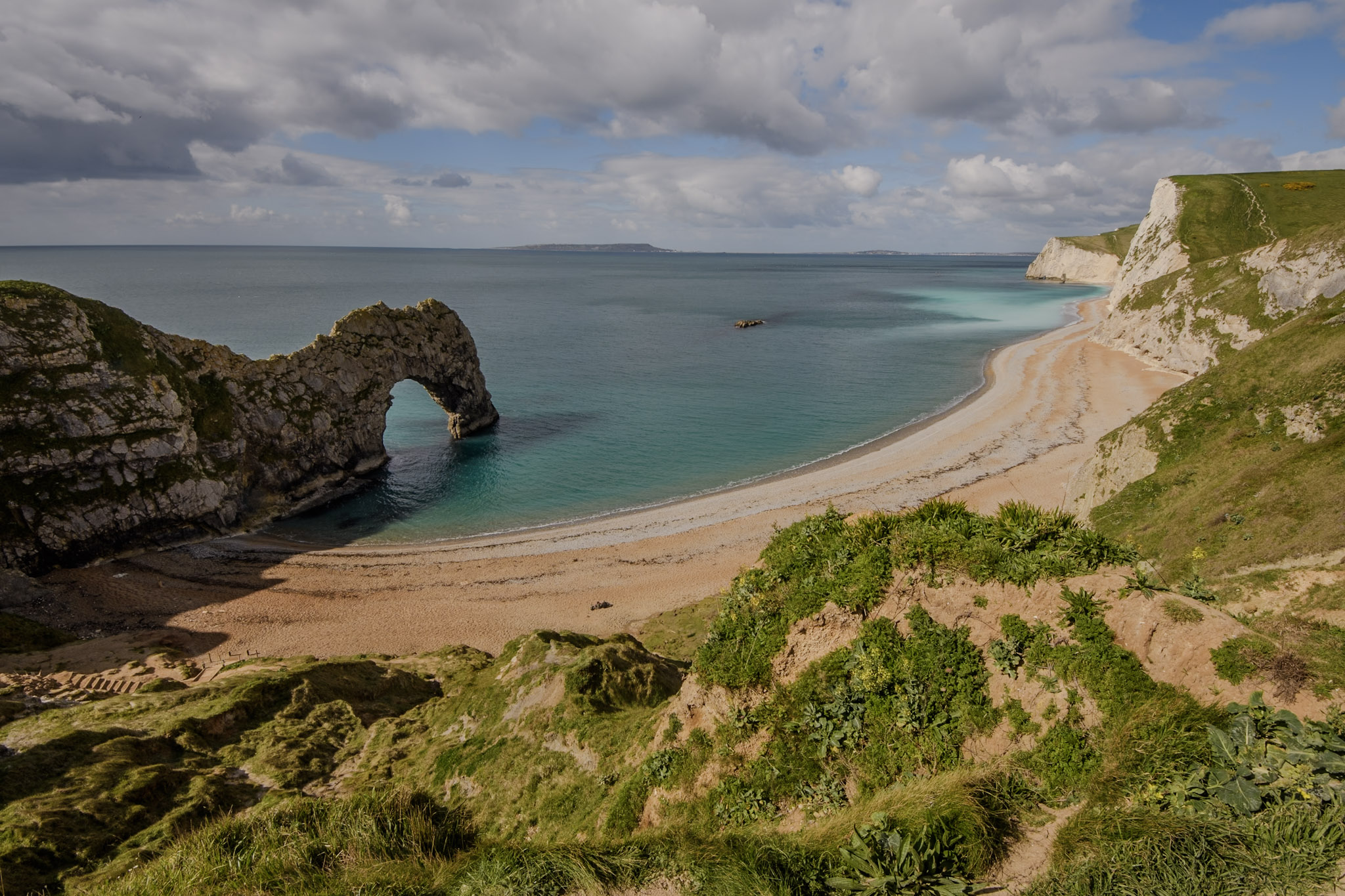
Above right: Durdle Door is one of the Jurassic Coast’s most iconic landforms. It is a natural arch through vertical beds of Portland Limestone (latest Jurassic).
Above left: The magnificent Lulworth Crumple at Stair Hole, Jurassic Coast. Here the Purbeck Limestone, which was once horizontal, is completely vertical and crumpled due to a huge fold called the Purbeck Monocline.
Above right: View of Chesil Beach, a barrier beach. This is a site of international importance for coastal geomorphology, firstly for its size, secondly for the systematic size-grading of the pebbles and cobbles alongshore and their lithological composition, and thirdly for the available historical records of beach changes.
Above left: Ammonites in a boulder on Monmouth Beach, Lyme Regis.
Above right: Amy examines some of the ammonites to be found in the Ammonite Pavement on Monmouth Beach, Lyme Regis. This is a limestone ledge where hundreds of ammonites of considerable size can be seen.
Day Four: Jurassic Coast
Above left: A beautiful example of a Asteroceras obtusum – unfortunately not an example that we found on our visit, but an example of the most sought after type of ammonite to be found in Lyme Regis which we were shown by our local guide!
Above top right: Our local guide, Chris Andrew, gives our group an introduction to the fossils of Lyme Regis next to the relatively new statue of arguably the most famous fossil collector of all time, Mary Anning.
Above bottom right: Dave examines an ammonite in a cracked nodule on Lyme Regis beach.
Day Five: Jurassic Coast – South Devon – Dartmoor – Somerset
Top left: The sandstone cliffs at Dawlish, Devon. The cliffs are formed from aeolian (wind-blown) sand which was laid down in a desert in a continental interior in the Permian Period roughly 250 million years ago. The rocks are part of the New Red Sandstone.
Top right: View towards Triangle Point, Torquay, in the English Riviera Geopark. This is Devonian aged limestone in Devon, the type area of the Devonian period.
Bottom left: Devonian aged marine fossils in the type Devonian area, at Triangle Point, Torquay. Corals and Goniatites can be seen in the black Devonian limestone.
Bottom right: Hay Tor in Dartmoor National Park. This classic site contains the best exposure of variants of the coarse, megacrystic granite of Dartmoor, together with a later, intrusive, fine-grained granite sheet. Its coarse-grained granites enclose a variety of genetically significant xenoliths.
Day Six: Cheddar – Bath – Crickhowell
Top left: This photograph was taken inside Gough Cave, Cheddar Gorge. This is a beautiful flowstone where water has flowed down and precipitated out the calcium carbonate.
Top right: The caves in Cheddar Gorge – home of the world famous cheese!
Middle right: Dave and Janine standing on the De La Beche unconformity in Vallis Vale. Here, in an old quarry the unconformity between the yellow-coloured, horizontally bedded Jurassic Inferior Oolite limestone and the underlying grey, massively bedded and steeply dipping Carboniferous Vallis Limestone can be seen.
Bottom right: The plaque on the wall of Tucking Mill commemorating its most famous occupant, the father of English geology, William Smith. He lived here while he was surveying the nearby Somerset Coal Canal.
Bottom left: Our group examine the now dry Combe Hay Locks on the former Somerset Coal Canal. William Smith, the ‘Father of English Geology’ worked as a surveyor on the canal and he was able to observe how the strata dipped regularly eastward, likening it to “slices of bread and butter”!
Day Seven: Crickhowell – Blaenavon – Fforest Fawr Geopark – Llandrindod Wells
Above left: The GeoWorld Travel group at Blaenavon Ironworks, in the Blaenavon Industrial Landscape World Heritage Site. The ironworks is located here due to the local geology, as iron ore, limestone and coal, all essential ingredients in the iron making process, outcrop in the area.
Above top right: Our group kitted up and ready to descend the mine at The Big Pit (National Coal Museum of Wales). The underground tour allowed us to see coal in situ as well as to learn about the life of a coal miner.
Above bottom right: Fossilised river channels in the lower Devonian Old Red Sandstone in the Fforest Fawr GeoPark. Early Devonian fossil land plant remains have been found in this quarry and were the first recorded in southern Britain.
Day Eight: Llandrindod Wells – Eryri (Snowdonia) National Park – Caernarfon
Above left: Hunting for Ordovician-aged trilobites at Gilwern Hill, located in the Builth-Llandrindod inlier. Other fossils found at the site include brachiopods, sponges and graptolites.
Above right: Part of an Oxyginus trilobite discovered by one of our group members at Gilwern Hill.
Above left: Caban Coch Dam in the Elan Valley. The reservoirs in the valley were built to supply water to the city of Birmingham. At either end of Caban Coch Dam is a Silurian (Llandovery) conglomerate which was formed in a submarine landslide.
Above top right: Barmouth in Eryri National Park lies in Sedgwick’s type Cambrian area. Outcropping in the mountain are many near-vertical strata representing a considerable expanse of the time period.
Above bottom right: Harlech Castle, built in the 1280s, sitting on Cambrian-aged rock in the Harlech Dome. The castle is part of the ‘Castles and Town Walls of King Edward in Gwynedd’ World Heritage Site.
Day Nine: Caernarfon – GeoMôn Geopark, Anglesey – Caernarfon
Above left: The GeoWorld Travel group at Llanfair PG(!) railway station, situated in the GeoMôn Geopark. This is the longest place name in Europe and the second longest one-word place name in the world! Literally translated, the long form of the name means: “[The] church of [St.] Mary [of the] pool of the white hazels near to the fierce whirlpool [and] the church of [St.] Tysilio of the red cave”.
Above top right: Large-scale human activity on the Great Orme began around 4,000 years ago during the
Bronze Age with the opening of several copper mines. Although the mine was still operated in the 19th century, it wasn’t until the 1980s that the prehistoric workings were rediscovered.
Day Ten: Caernarfon – Eryri (Snowdonia) National Park – Shrewsbury
Above left: A view of Dinorwig slate quarry from Dolbadarn Castle. The slate quarry is part of the ‘The Slate Landscape of Northwest Wales’ UNESCO World Heritage Site. The slates are Lower Cambrian in age and are in Sedgwick’s type Cambrian area.
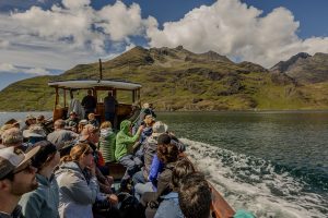
Above top right: The group in Eryri National Park. The highest peak Yr Wyddfa (Snowdon) is in the centre background, but is obscured by cloud!
Above bottom right: Llyn Idwal in Eyri National Park. In the background, several glacial erratics can be seen; these are known as Darwin’s Boulders. It was here that Charles Darwin first realised that Britain must once have been glaciated.
Day Eleven: Shrewsbury – Lyth Hill – The Wrekin – Ironbridge – Wenlock Edge – Shrewsbury
Above left: The GeoWorld Travel group on Precambrian (Ediacaran) aged conglomerate at Lyth Hill in Shropshire.
Above right: The Ercall unconformity in Shropshire. Here Cambrian aged quartzite is seen resting unconformably on Ediacaran aged granophyre.
Above left: The world’s first built iron bridge, opened in 1781, in the ‘Ironbridge Gorge’ UNESCO World Heritage Site.
Above top right: Knowle Quarry on Wenlock Edge, the type area of the Wenlock epoch of the Silurian. The Wenlock Limestone Reef Facies consists of flat-bottomed lenticular masses of reef limestone (‘ballstone’) up to 80 ft (24 m) in thickness surrounded by bedded nodular limestone with siltstone beds.
Above bottom right: The GeoWorld Travel group at Murchison’s View. From here, Murchison could see all the strata in his Silurian system stacked against the Lawley Mountain (seen in the background on the left) which is made up of Ediacaran and Cambrian aged rock.
Day Twelve: Shrewsbury – Ludlow – London
Above left: The GeoWorld Travel group at the Onny Valley unconformity between the Caradoc (Ordovician) and Llandovery (Silurian) rocks. This subtle unconformity was completely missed by Murchison. It was discovered in 1854 and shows there was a considerable time gap between what was previously regarded as his upper and lower Silurian. Its discovery was one of the key pieces of evidence that led on to the founding of the Ordovician Period by Charles Lapworth in 1879.
Above right: One of the final stops of our trip – the group at the Gorstian Stage GSSP. This is not only the global stratotype for the boundary between the Homerian and Gorstian Stages, but also marks the boundary between the Wenlock and Ludlow epochs. These epochs were both named after towns within the local area.
Day Thirteen: Departure day


